Prescribed burns at Fort Ord are an environmental disaster
The Army plans a massive burn this fall.
By Pat Elder
May 19, 2025
Please support our work. We are raising money to pay for environmental testing at Fort Ord in the fall. We’ve raised $6,500. We’d like to double this amount. We will test for volatile organic compounds, dioxin, depleted uranium, PFAS, and other contaminants in air, water and soil. Please help us! Every dollar makes a difference. See our website.

Beautiful California coastal chaparral, teeming with wildlife at the former Fort Ord

A prescribed burn at Fort Ord

Toxic explosive items at Fort Ord exposed after destruction of dense chaparral wildlife habitat.

Residential homes built over a contaminated military site at the former Fort Ord.
The U.S. Army has announced its intention to hold a prescribed burn within the lands controlled by the Bureau of Land Management within the Fort Ord Superfund site designated as National Monument. The area, known as Unit A, contains 305 acres and is bounded on the north by Lion’s Revenge Road; on the east by Hennekens Ranch Road; on the south by West Machine Gun Flats Road; and on the west by Watkins Gate Road.

Unit A contains approximately 305 acres. Prescribed Burn Plan Update, April, 2025
A specific date has not been set for the 2025 prescribed burn, although September and October tend to present a window for the least threatening of scenarios. Project meteorologists will attempt to identify a suitable burn window - that is, an opportunity that meets the burn prescription requirements. According to the Army, the greatest risk associated with the Unit A burn is “finding an acceptable burn and smoke dispersion window.” This means they hope the smoke rises far into the air and drifts away. However, wherever it drifts, the chemically laden plume does immeasurable harm to the earth.
The primary goal of the prescribed burn is to clear vegetation covering Unit A acreage so that munitions and explosives of concern (MEC) are visible and can be removed safely.
MECs are potentially deadly. They include:
Unexploded Ordnance (UXO) - Munitions that were fired or discarded, but did not explode and still pose a risk of detonation. It is estimated that up to 10% of the munitions at Fort Ord failed to detonate.
Discarded Military Munitions (DMM) - Munitions that were abandoned or buried and may still contain explosive components.
Munitions Constituents (MC) - Chemical residues from munitions (like TNT, RDX, or heavy metals) that may pose environmental or health risks, but not necessarily an explosive hazard.
If 10 million munitions were used throughout Fort Ord (likely a conservative estimate), and we assume a 5% dud rate (another conservative estimate), that would mean about 500,000 UXO items have been left behind by the Army.
A 1994 New York Times article stated that 1.5 million soldiers had trained at Fort Ord by the time of its closure. Each soldier typically fires thousands of a variety of explosive rounds during basic and advanced training.
As of February 2025, the Fort Ord cleanup program had removed only 79,034 Munitions and Explosives of Concern.
Burn Hazards
Nina Beety, a well-known environmentalist in Monterey, sent her comments to be published in the Fort Ord Cleanup record on April 30, 2025. However, to date, the Army has not posted her comments. Ms. Beety addresses several issues regarding the plan to burn this 305 acres of contaminated land:
I oppose the prescribed burn outlined in the draft addendum planned for Area B, Unit A.
The contamination at the Fort Ord National Priorities List Superfund Site is an ongoing and severe problem. There are no easy solutions. “Cleaning” and clearing it of hazards is extremely difficult. Re-badging this area as a National Monument has not changed the underlying problems, and giving the public recreational access to this Superfund site is reckless and a violation of the public trust.
A) Due to well-known poor record-keeping by the Army, the full extent of contamination and hazardous conditions will likely never be known, nor where trainings, testing, and experiments took place, and contaminants were used. In addition, this is in proximity to Site 39 – the most contaminated area of the Superfund Site. Neat lines on a map are not limiting barriers for contamination spread.
B) There should be no public access to these degraded lands. Munitions and chemical contamination will always be present. This puts public users at risk, especially as there appears to be no full informed consent from public users that includes toxics exposure information.
C) Burns are a hazard. Those hazards include poison oak's noxious oils, and hazardous waste and their vapors including from chemical weapons, herbicides, and munitions chemicals contaminating the soil and uptaken by plants. The incendiary chemicals are also a hazard.
When burned, the smoke spreads these contaminants to the surrounding area, as well as particulate matter. This poses an inhalation and fall-out hazard to the region, particularly to those residences and towns closest to the burns. Those with existing health problems, including asthma and other lung problems are at even greater risk.

The federally threatened California Tiger Salamander
lives among the unexploded munitions.
D) Burns destroy habitat and kill wildlife. People have even reported seeing animals fleeing and on fire, from burns at Fort Ord.
E) Range fires are not normal for this region. This is not a fire-adapted area. Lightning is rare in this region. Chaparral is a slow-growing vegetation that takes decades to become established. Once destroyed, more resilient, fast-growing, and flammable vegetation including grasses will take its place.
F) Burns can cause UXOs to explode, sending metal fragments and additional chemical contamination into the area.
Thank you, Nina Beety.
Chronology of Burn Events:

The map shows the burn year and previously burned units dating back to 2003. The area planned for a prescribed burn in 2025 is highlighted in purple. Fort Ord Prescribed Burn Program
1994 – July – 28 acres, Area OE-5; August – 60 acres, Area OE-47
1995 – August – 24 acres, Area OE-19; Area OE-10A, 113 acres.
1997 – September, 17, 1997 – A prescribed burn on September 17, 1997 (Area 0E10B) was originally intended to cover 100 acres, but due to unexpected wind shifts, it escaped containment and expanded to 700 acres, severely shrouding the Monterey Peninsula in smoke and generating mass complaints. "People living in cities 20 miles away had to drive with their headlights on because the smoke was so thick,” said Douglas Quetin, air pollution control officer for the Monterey Bay Unified Air Pollution Control District.
"It was going off like popcorn." said one fireman. Quetin testified "I heard a substantial number of small explosions coming from the area of the August 25, 1997 fire." That 32-acre fire went out of control because "there was too much ordnance detonating," and fire-fighting personnel had to be pulled back for their safety. - David Dilworth
Metro Silicon Valley reported on the 1997 fire: “The burn went according to plan for about two hours. Then something went awry. An unexpected offshore breeze assaulted the plume, pushing it hard inland and down onto local communities. Nineteen-year-old Stacie Halas stared in awe at the plume heading toward her from the window of her California State University Monterey Bay dorm room, northwest of the burn site.”
"It was sunny and then suddenly this gray overcast," resident Helen Johnson recounted. The plume moved into the Salinas Valley and the town of Spreckels, southeast of the burn.
Kathy Odom, a Spreckels Elementary School health aide, said that the air was black with ash by early afternoon, and ash was collecting on the desks. "It was that thick."
1998 – September – 60 acres, Area OE44; 113 acres, Area OE10A.
The Monterey Bay Unified Air Pollution Control District sued the Army to stop the prescribed burns, but the court ruled the district could not control how the Army clears vegetation.
2003 - On October 24, 2003, a prescribed burn intended to clear approximately 500 acres unexpectedly expanded to 1,470 acres due to winds which then blew the smoke over heavily populated areas.
David Dilworth wrote this warning after the disastrous 2003 fire.
“The Army wrote in a 1994 evaluation report (and confirmed at a 2000 RAB hearing) that the "bombs and projectiles with a diameter of 5 inches or more" will explode and send hot fragments some four thousand feet (4,000) and will start secondary fires "with 100 percent certainty!" This means those hot fragments can travel anywhere in a circle of 8,000-foot diameter and start a new fire.”

There is debate over what caused the fire to explode the way it did. One theory is that exploding bombs will start fires far away. Another is that burning embers were picked up by the wind and carried to areas that were not intended to be burned. Another theory is that sparks from the igniter were accidentally thrown across the containment line. The Army isn’t clear about this, although these sorts of accidents are a regular part of prescribed burns. See 2004 Prescribed Burn Review
2006 - October – 79 acres, MRS 16. The site is located near the Bureau of Land Management (BLM) headquarters and was identified as a priority site due to the concentration of UXO and associated risks to public safety.
2008 – December –137 acres, Unit 18; 23 acres, Unit 22. The Army also announced in 2008 that it planned to conduct prescribed burns in about 6,560 acres of the historical Impact Area at Site 39 at Fort Ord by 2016.
2009 - “A significant burn cleared over 250 acres in Burn Unit 14. The fire was started at 9:45 a.m. on October 6 but the ignition phase was shut down at 11:15 a.m. because the weather factors had changed and were altering the direction of the smoke. The firefighting crew, which included six helicopters, quickly converted from lighting the fire to putting it out. The burn was conducted the next day.”
– U.S. Army
2010 - October - 117 acres, Unit 21; 195 acres, Unit 15.
2013 - October – 279 acres, Unit 10; 310 acres, Unit 7.
According to Rock P. Wood, Wildfire Today “A prescribed fire on Fort Ord near Monterey, California escaped Tuesday. The objective of the fire was to remove vegetation to make it easier to clear the area of unexploded ordnance.”
The fire burned 100 acres more than planned.

Fort Ord prescribed fire 10 a.m. October 15, 2013. Photo by Rock. Wildfire Today
“The fire was ignited in the morning and at 6 p.m. the Army said it was contained. Between 9 p.m. and 11:30 p.m. a large smoke plume was seen in the area. We were hit with higher than predicted winds. Several engines tried to hold the line but zero visibility conditions for ground pounders, prevented us from picking it up and an escape was declared. All resources at the burn worked their asses off and were successful at stopping the fire at the next containment line… An interesting side note; because of the unexploded ordinance in the burn area, it was not possible to go direct and we had to wait for the fire to come to us (on roads) to fight it. Despite the slop-over, this burn was a success, and we had no injuries to firefighters.”
2017 - October –250 acres, BLM Area B Unit B; 119 acres, BLM Area B Unit 6.

Fires – Total Acres Burned
There have been no additional prescribed burns since 2017.
For more information, History of Fort Ord Prescribed Burns - Fort Ord BRAC Field Office – May 23, 2018 https://docs.fortordcleanup.com/ar_pdfs/AR-BW-2841.7//BW-2841.7.pdf
Lessons not learned:
· Undeniable threats to human and environmental health
· Inability to accurately predict the winds
· Impact of UXO explosions on fire spread
· UXO explosions posing a safety risk for firefighters and limiting their ability to work
· Burning embers crossing containment lines
· Careless ignition from Army helicopters
· Putting new development on contaminated lands.
· The need to put a fence around it and keep people out.
=============
Dioxins and Furans
According to the EPA, prescribed burns produce dangerous amounts of airborne dioxins and furans. Dioxins and furans are deadly chemical compounds that are byproducts from burning chlorinated materials, such as herbicides, and military munitions that litter Fort Ord. Dioxins include TCDD (2,3,7,8-tetrachlorodibenzo-p-dioxin), found in the Agent Orange routinely sprayed on 9,000 acres at Fort Ord.
Dioxins and furans are frightening because of their extreme toxicity, their persistence, and their tendency to accumulate in the food chain. They are among the deadliest carcinogens known. Human and wildlife exposure typically occurs through inhalation of contaminated air — such as smoke from prescribed burns.
These compounds become airborne attached to fine particulate matter and can travel long distances before settling in the lungs. Air samples at Fort Ord confirmed the presence of these carcinogens in the air during past burns.
What’s in the air?
The US Army has a long history of understating, ignoring, and denying contaminants. This is how they described the results of a burn at Fort Ord. “The Army conducted extensive air monitoring during the 2003 prescribed burn. No contaminants associated with detonation of unexploded ordnance and explosives were detected. This means that smoke, ash, and debris from this fire at Fort Ord was no different than it would have been from a fire anywhere with similar vegetation.”
This is not credible.
In addition to the contaminants already mentioned: dioxin contaminates the soil and burning lofts it into the air. Quantities of carcinogenic PFOS were used around the base, and it also becomes airborne during a fire. Toxic compounds including RDX, TNT, and perchlorate found in the soil at Fort Ord may lift into the air and smoke during a prescribed burn as well. Heavy metals like copper and lead from munitions casings are persistent contaminants. These are just a few of the contaminants in and around this site.
When we breathe these toxic substances, they can sicken and even kill us. Children and those with pre-existing medical conditions are most vulnerable. Burning in proximity to seasonal waterways and streams or the resultant fallout cause surface water contamination.
White Phosphorus
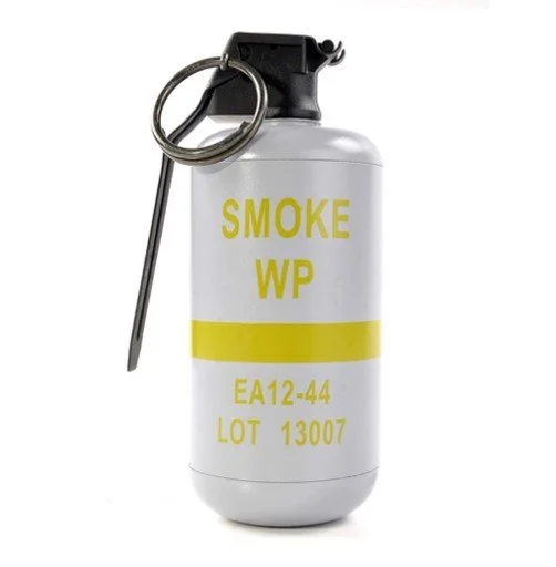
M15 White Phosphorus Smoke Grenade
On August 29, 2009, a wildfire burned approximately 7 acres of moderate density vegetation on the former Fort Ord approximately 250 meters northeast of the intersection of Evolution Road and Broadway Ave. inside the Fort Ord impact area at Site 39. The suspected cause was the spontaneous ignition of a type of hand-grenade used for generating smoke, specifically using white phosphorus. It is known as the M15 White Phosphorus Smoke Grenade. - Army investigation of MEC incident, 2009
When white phosphorus ignites, it becomes airborne as fine particulate matter. Inhalation of white phosphorus particles during prescribed burns at Fort Ord poses serious health risks. Inhalation can cause severe respiratory damage, including coughing, shortness of breath, and potentially fatal complications like pulmonary edema and organ failure due to its highly toxic and corrosive nature. White phosphorus lifted into the air during a prescribed burn can cause severe, deep skin burns by igniting on contact with air and continuing to burn into the body after it adheres to the flesh.

Satellite image of smoke dispersed
from Fort Ord on October 24, 2003.
The Fort Ord Community Advisory Group (FOCAG)
We’ll give the Fort Ord Community Advisory Group (FOCAG) the last word in our discussion of prescribed burns at Fort Ord. FOCAG is a grassroots public interest group dedicated to monitoring and accountability on the environmental cleanup of Fort Ord. FOCAG was established in response to the U.S. Army's dissolution of the Fort Ord Restoration Advisory Board (RAB). Following the dissolution, the California Department of Toxic Substances Control (DTSC) assisted in forming FOCAG to ensure continued community involvement in the cleanup process
FOCAG reports first appeared in the Fort Ord “Cleanup” record in 2004. There are 110 FOCAG files in the database. It is instructive to read them. https://www.fortordcleanup.com/documents/search/
FOCAG does not receive state or federal dollars so they can independently and objectively report on the research they gather and advocate for human and community health with no conflict of interest amidst the omnipresent and overlapping layers of captured state, federal, and municipal officials and bodies and corporations that claim all is well at Fort Ord.
From Mike Weaver, Co-Chair of the Fort Ord Community Advisory Group, (FOCAG)
Note: This letter was submitted to the Fort Ord Cleanup record, although. like Nina Beety’s letter, it has not appeared.
For the Fort Ord Clean Up Administrative Record
April 29, 2025
Following the last two wildland burn disasters on the former Fort Ord, the Fort Ord Community Advisory Group (FOCAG) was relieved to hear that prescribed burns were to stop. This was due to out-of-control burns that threatened residences on or near the Highway 68 Corridor, as well as causing toxic smoke to blow west, then south in Monterey County.
1) FOCAG claims that letters critical of the Army’s Prescribed Burns have disappeared from the Administrative Record
2) FOCAG claims U.S. munitions were being built so fast and furious during times of U.S. war involvement that an estimated 10% of the munitions fired on former Fort Ord failed to go off.
3) FOCAG questioned if BRAC considered the chemical Urishiol in Poison Oak that gets burned, goes up in the smoke, then is carried downwind to area residents. FOCAG also questioned how the Agent Orange sprayed throughout the base affect the toxicity of the smoke.
4) Agent Orange was used on Fort Ord to kill Poison Oak. It was part of the CDEC experiment exercises. How does burning areas of former Fort Ord affect area residents due to this toxic smoke? What are the health problems associated with Agent Orange exposure?
5) I am familiar with Fort Ord wildland fires going back to the 1950’s. Planes used to drop chemical sprays on the fires to slow them down and maybe to put them out. What chemicals were in those various plane drops? They were different colors. How many different mixtures of fire retardant were tried on Fort Ord over the years?
6) How many Fort Ord fires have gotten out of control since 1950 according to BRAC’s records?
7) How many acres were burned with each out-of-control fire? Please provide a list.
8) How many Fort Ord fires were determined to be accidental? How many of the Fort Ord fires were intentional?
9) How does BLM justify fires at Fort Ord when their surrounding residential neighbors have had their homeowner’s fire insurance rates increase dramatically, and in some cases had their insurance cancelled due to fire risk?
10) How does BLM plan to reimburse residential neighbors for their annual fire insurance policy cost increases? BLM is creating additional wild land fire risk spreading to other areas.
11) Are the planned “prescribed burns” lit with a Napalm or Alumagel mix? Please advise as to the chemical make up of fire-starting agents.
12) What is the proposed Burn Plan? On the day of a burn, does BRAC/BLM wait until the coastal winds are blowing westward? This is what was done in the past. The heavy toxic smoke blows westward, filling up both the Corral de Tierra and the San Benancio Canyons with thick smoke and falling ash. The wind then begins to blow the smoke south on the Highway 68 route, over the town of Spreckels, and then further south down the Salinas Valley covering the agricultural fields with layers of smoke and ash.
The Fort Ord Community Advisory Group looks forward to comprehensive answers in a Draft/Final document.
Respectfully,
Mike Weaver
Co-Chair, FOCAG
Please support our work. We are raising money to pay for environmental testing at Fort Ord in the fall. We’ve raised $6,500. We’d like to double this amount. We will test for volatile organic compounds, dioxin, depleted uranium, PFAS, and other contaminants in air, water and soil. Please help us! Every dollar makes a difference. See our website.