The Toxic Legacy of Eighty Years of U.S. Military Occupation
Part 2 of a 3-part series. Part 1 examined PFAS at Pituffik Space Base; while Part 3 will survey the appeals U.S. veterans have filed with the U.S. Veterans Administration, claiming cancers and disease as a result of their exposure to toxins in Greenland.
By Pat Elder
July 9, 2026

“Greenland doesn’t really help Denmark. Denmark doesn’t spend money to really help Greenland, but it’s important for the United States... It should be controlled by the United States, not by Denmark.” — U.S. President Donald Trump, speaking in Ankara, Türkiye, July 7, 2026, Photo CNBC
Introduction
President Donald Trump's July 2026 remarks criticizing Denmark's relationship with Greenland provide an unexpected backdrop for this report. Although the President did not specify what he meant by Denmark "not spending money to really help Greenland," his comments invite a broader examination of the responsibilities that accompany the American military presence and strategic interest on the world's largest island.
The geopolitical tensions have been extraordinary. Following President Trump's repeated suggestions earlier this year that he might use military force to acquire Greenland, Danish military planners reportedly developed highly classified contingency plans that included destroying key Greenlandic airfields if the United States attempted an invasion, according to the BBC.
On April 1, 2026, The New York Times reported that the Trump administration was negotiating with Denmark for access to three additional military installations in Greenland. According to the newspaper, two of the proposed sites were former American bases abandoned following the Cold War. The report underscored Greenland's renewed strategic importance at a moment when many of the environmental consequences of earlier U.S. military operations remain unresolved.
For more than eighty years, the United States has maintained an extensive network of military installations across Greenland. Those bases left behind nuclear radiation, fuel spills, abandoned infrastructure, military waste, contaminated landfills, PCB-containing materials, asbestos, unexploded ordnance, and, at several locations, documented PFAS contamination associated with firefighting activities.
Successive Danish and Greenlandic governments have invested substantial public resources investigating former American installations, documenting contamination, and, in some rare cases, undertaking cleanup projects. The United States has strongly maintained that it bears no legal obligation to restore former facilities to their original condition, relying on provisions contained in Article XI of the 1951 Defense Agreement: “It is understood that any areas or facilities made available to the Government of the United States of America under this Agreement need not be left in the condition in which they were at the time they were thus made available.”
As a result, almost all of the financial burden for assessing and addressing contamination has fallen on Denmark and Greenland rather than on the guilty party that established and operated the installations.
When the U.S. upgraded its radar systems in 2004, Greenland attempted to compel the United States to clean up former U.S. bases on the island. U.S. Secretary of State Colin Powell stated that the legal responsibility for cleaning up older, abandoned bases had already transferred to local/Danish authorities and would remain there. Because the U.S. maintained this legal stance, the Danish government ultimately agreed to pay for the cleanup.
In 2018 the Danish government relented by investing around 24 million Euro to “clean-up” the abandoned bases. It is a paltry sum. By 2024, progress on the clean-up had been slow. Only around 5.3 million Euro has been spent. That figure is almost irrelevant when measured against the scale of cleaning up the horror at Camp Century alone.
No public authority has produced a comprehensive cleanup estimate for Camp Century. Given the scale of the buried infrastructure, the Arctic environment, and the costs associated with excavating, transporting, and disposing of radioactive and hazardous materials, the eventual cost could reasonably reach into the billions of euros.

This report provides a consolidated overview of former United States military installations in Greenland and their documented environmental legacy. It is based primarily on the groundbreaking investigative reporting and field research published by the Danish newspaper Politiken supplemented by publicly available reports from the Government of Greenland, the Geological Survey of Denmark and Greenland (GEUS), NIRAS, U.S. government agencies, scientific literature, and historical records.
Military Poisons is indebted to the journalists, editors, photographers, and researchers at Politiken for their exceptional work documenting the environmental legacy of former U.S. military activities in Greenland. Their reporting has significantly advanced public understanding of these historically important sites and provided an invaluable foundation for further research.
The individual descriptions of each installation have been substantially condensed from the original source material to provide readers with a concise reference to the history, environmental conditions, and current status of each site. While every effort has been made to accurately reflect the available public record, this report is intended as a summary and research aid rather than a substitute for the original investigations and technical reports.
Taken together, these installations reveal a remarkably consistent pattern spanning more than eight decades of American military operations in Greenland. Facilities ranging from major air bases to isolated weather stations and LORAN navigation sites were frequently abandoned with fuel drums, vehicles, construction materials, electrical equipment, batteries, hazardous building materials, and waste disposal areas left in place. Environmental investigations have repeatedly documented petroleum contamination, Polychlorinated biphenyls PCBs, asbestos, mercury, lead, cadmium, and other heavy metals, while many sites remain only partially characterized because comprehensive environmental assessments have never been completed. Camp Century occupies a category of its own. Unlike the conventional military installations scattered across Greenland, the underground nuclear-powered base left behind highly toxic radioactive waste, diesel fuel, sewage, and thousands of tons of construction materials beneath the Greenland Ice Sheet.
One of the more striking findings is how unevenly these sites have been investigated. A few former bases have undergone detailed engineering studies involving soil, water, sediment, and waste characterization. Others have received only scant historical inventories documenting visible structures and debris. Several installations—including Camp Tuto, Camp Fistclench, the Ice Cap Sites, and a number of protected-area weather stations—have never undergone comprehensive environmental assessments.
Cleanup efforts have likewise been inconsistent. Denmark initiated a political agreement in 2018 to begin addressing contamination at selected former American installations, but remediation has progressed slowly. Several major sites remain only partially cleaned despite years of planning. Other installations, including Pituffik Space Base and several research camps within the active military reservation, are excluded from testing and remediation because they remain operational. Somehow, sharing environmental secrets involving levels of PCB’s, PFAS, Radiation, and Mercury are matters of national security. The same holds true from Weisbaden, Germany to Yokosuka, Japan to Honolulu, Hawaii. Victims in these locations cry out for data and justice.
As Greenland assumes greater strategic importance and climate change accelerates the exposure of long-buried Cold War infrastructure, the environmental legacy of former U.S. military installations is likely to receive increasing international attention. This report seeks to provide a concise, evidence-based reference to what is presently known about these sites, where significant uncertainties remain, and where additional investigation is long overdue.
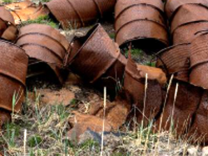
What’s in a drum?
Throughout Greenland, former American military installations are littered with hundreds of thousands of abandoned steel fuel drums. Many reportedly contained residual gasoline, kerosene, diesel fuel, lubricating oil, or other petroleum products when they were discarded. As these drums corrode over time, residual fuels and additives leach into surrounding soils and surface waters. Among the contaminants of greatest concern are petroleum hydrocarbons and volatile organic compounds, particularly the BTEX chemicals—benzene, toluene, ethylbenzene, and xylenes—along with polycyclic aromatic hydrocarbons (PAHs) and other fuel constituents, like PCB’s. See our rundown on the 36 contaminated sites below. First, please consider helping us financially.
_______________________________________________________________________________________________
Before reading on, Please support our testing in Fort Ord, California.
The distance from Fort Ord, California, to Nuuk, Greenland is only about 3,300 miles. Most people are surprised to learn that.
This fall, I will travel to Fort Ord to meet with a dozen local environmental advocates, scientists, and Army veterans who are deeply concerned about the rapid redevelopment of the former Army base. New apartments, homes, schools, parks, and retail centers continue to be built over land that contains some of the military's deadliest legacy contamination.
Over the years, almost 2,000 local residents, former service members, and civilian workers have told us about cancers and other illnesses they believe are connected to their exposure at Fort Ord.
We are especially concerned about large groundwater plumes containing trichloroethylene (TCE), tetrachloroethylene (PCE), and carbon tetrachloride (CT). These chemicals can migrate into buildings as vapor, potentially affecting the air people breathe inside their homes and workplaces. We are also concerned about the possible presence and movement of PFAS ("forever chemicals") and other toxic contaminants in groundwater, soil, surface water, and indoor dust.
Our goal is to collect independent environmental samples, work with qualified experts, and make the results available to the public. We believe communities deserve reliable information about the environment where they live, work, and raise their families. We need your help. We need to pay for airfare for three of us (from Maryland, Ohio, and Michigan). We must pay for lodging for four nights. (two stars..) And then, we have to pay for the testing. We already have the Cyclopure test kits for PFAS. We still need to pay for testing of soil, air, and water at different locations. $10,000 is our goal.
See who “we” are.
If you have supported Military Poisons in the past, we hope you will consider helping us again. If you didn’t receive a personal thank you, I apologize. Every donation helps us bring greater transparency to this community living with the environmental legacy of military contamination.
Thank you for standing with us. Go here, to the bottom of the page to contribute. https://www.fortordcontamination.org/ Now, back to Greenland.
_______________________________________________________________________________________________
Part I — The Bluie West Installations
Bluie West 1 (Narsarsuaq) U.S. Operation:1942–1958
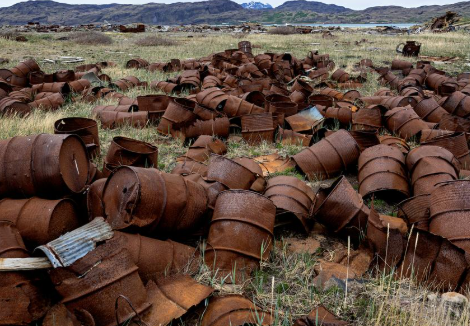
The largest American air base in Greenland during World War II, Bluie West 1 served as a major refueling stop for thousands of aircraft enroute to Europe. When the United States departed in 1958, it left behind extensive debris, including aircraft wreckage, oil drums, batteries, cables, machinery, buried scrap metal, and asbestos from the former military hospital. Local officials report that waste was buried in multiple layers beneath the site. Although asbestos hazards have been documented for years, the installation is not included in Denmark's current cleanup program.
Note: Bluie West Two was a planned World War II United States military site in southwest Greenland that proved unusable and was ultimately rejected.
Bluie West 3 (Simiutaq) U.S. Operation:1942–1958
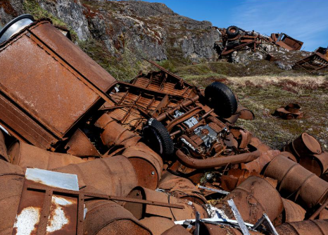
Established as a weather and radio station supporting aircraft operations at Narsarsuaq, Bluie West 3 now contains approximately 4,400 metric tons of abandoned military waste. The site includes rusting oil drums, construction materials, battery components, shipwreck debris, pipelines, and large abandoned fuel tanks. Environmental investigations have documented severe petroleum contamination, including mobile free-phase oil capable of migrating through soil. Elevated PCB concentrations, lead contamination, and petroleum impacts to nearby marine sediments and mussels make Simiutaq one of Greenland's most extensively documented contaminated military sites.
Bluie West 4 (Marraq / Teague Airfield) U.S. Operation: 1942–1948
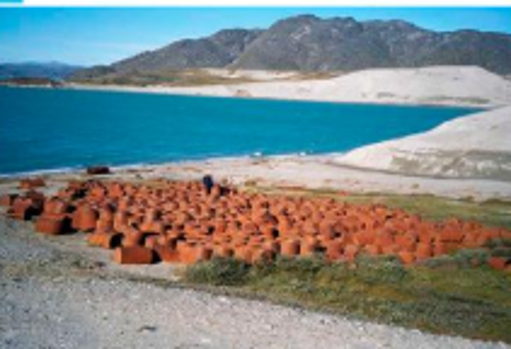
Built as an emergency landing field and weather station south of Nuuk, Marraq was abandoned with thousands of oil drums, diesel generators, vehicles, radio equipment, barges, and buried scrap metal. Investigators estimated that at least 120,000 liters of diesel fuel contaminated the site, with petroleum odors still evident decades after abandonment. Surveys also identified asbestos, PCBs, and mercury contamination. Officials concluded that pollutants posed potential risks to freshwater ecosystems, marine organisms, and shellfish inhabiting the adjacent fjord. Cleanup operations began in 2019 but remain unfinished.
Bluie West 5 (Aasiaat) U.S. Operation:1942–1958
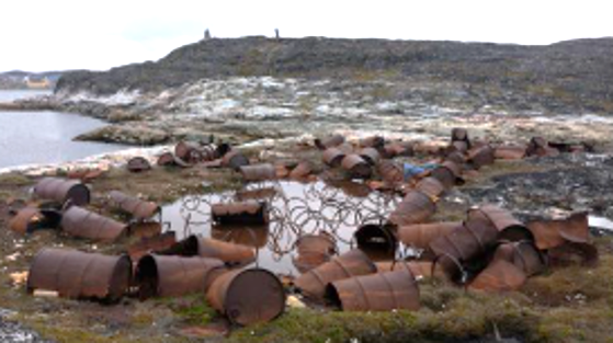
Bluie West 5 functioned as a weather station near present-day Aasiaat during World War II. Although the site has been used for other purposes over the years, environmental investigations have clearly identified American military debris, including deteriorating buildings and stockpiles of rusted oil drums. More than five metric tons of hazardous or contaminated waste remain. Soil testing has documented elevated concentrations of lead and cadmium associated with the former U.S. installation. Questions regarding present ownership have complicated decisions concerning remediation.
Bluie West 6 (Pituffik / Thule Air Base / Pituffik Space Base) U.S. Operation:1942–Present
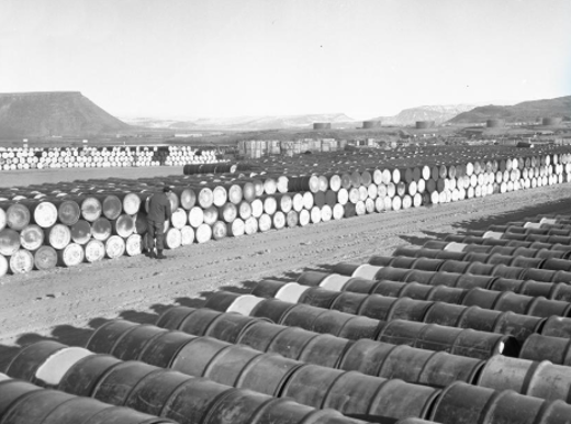
Originally established as the Bluie West 6 weather station during World War II, the installation expanded dramatically under the secret Project Blue Jay and became Thule Air Base in 1952, now known as Pituffik Space Base. The installation remains the only active U.S. military base in Greenland. Historic investigations have identified at least fifty waste disposal areas surrounding the base, including former missile silos converted into landfills. Long-term PCB contamination has been documented in nearby marine environments, but because the base remains operational, it has largely been excluded from Denmark's national cleanup program.
Bluie West 7 / Navy 26 / Grønnedal
U.S. Operation:1943–1951 (later operated by Denmark until 2012)
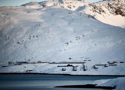
Established near Ivigtut during World War II, Bluie West 7 was accompanied by the adjacent U.S. Navy 26 installation, later transferred to Denmark and renamed Grønnedal. Investigations have documented extensive petroleum and groundwater contamination migrating toward Arsuk Fjord. Large American dump sites contain vehicles, hazardous wastes, and an estimated 20,000 cubic meters of discarded material. Underwater surveys have identified additional debris in the fjord, including a tanker truck, crane, tracked vehicle, and other equipment. Cleanup costs are now estimated at between DKK 100 and 200 million.
Bluie West 8 (Kangerlussuaq / Søndre Strømfjord) U.S. Operation:1941–1992
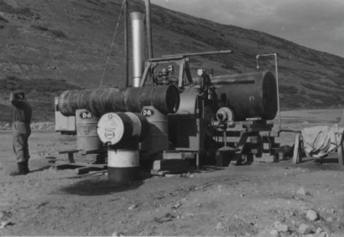
Built before the United States entered World War II, Kangerlussuaq became one of Greenland's most important military airfields and later served Cold War radar operations before transitioning into Greenland's principal civilian airport. The United States left behind oil drum dumps, unexploded ammunition, scrap metal, and abandoned military structures. Local residents have criticized the burning of open landfills containing American military waste. Greenlandic officials have also alleged that diesel fuel was intentionally dumped into nearby lakes for mosquito control, with reports that some waters still exhibit petroleum odors decades later.
Bluie West 9 (Cruncher Island) U.S. Operation:1942–1986
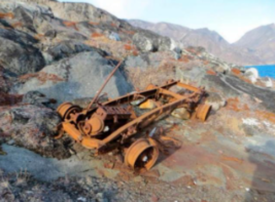
Constructed to support weather observations and aviation operations associated with Kangerlussuaq, Bluie West 9 remained active for more than four decades. The abandoned installation contains building ruins, generators, vehicles, cables, pipes, waste dumps, and approximately 1.5 metric tons of discarded batteries. Environmental investigations documented elevated concentrations of petroleum, lead, cadmium, copper, zinc, and mercury in soils. Approximately eleven metric tons of hazardous or contaminated waste remain. Danish and Greenlandic authorities have identified the site as a priority for future cleanup.
Part II — The Bluie East Installations
Bluie East 1 (Ikerasassuaq / Prince Christian Sound) U.S. Operation:1942–1945 (later operated by the Danish Meteorological Institute) No Photo
Established as a weather and radio station near Cape Farewell, Bluie East 1 played an important role in Allied North Atlantic weather forecasting during World War II. The installation consisted of a harbor, power plant, radio facilities, living quarters, and support buildings connected by a long wooden staircase. Unlike many other American installations in Greenland, little is known about what environmental contamination remains. Danish authorities report that no formal environmental assessment has been conducted, leaving uncertainty about whether hazardous materials from the wartime occupation persist beneath or around the site.
Bluie East 2 (Ikkatteq) U.S. Operation:1942–1947
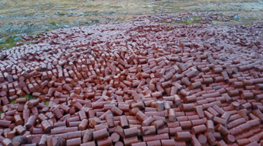
Ikkatteq was one of the largest American airfields on Greenland's east coast, serving as both a refueling stop and radio surveillance station with a wartime population approaching 600 personnel. When abandoned, the base contained more than 100,000 oil drums scattered across the landscape, dozens of military vehicles, batteries, collapsed buildings, and structures containing asbestos. Environmental investigations documented extensive petroleum contamination together with PCBs, lead, and cadmium. Authorities concluded that contamination posed direct risks to both wildlife and people. Although cleanup began years ago, significant remediation remains unfinished.
Bluie East 3 (Walrus Bay) U.S. Operation: 1942–1945
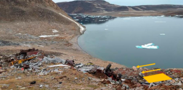
This small weather and radio station on Greenland's east coast supported Allied operations with a complement of approximately fourteen personnel. Although relatively modest in size, environmental investigators classified the site's overall environmental impact as significant. Abandoned structures, fuel drum storage areas, and military debris remained after the American withdrawal. Scrap metal was removed in 2022, but no comprehensive environmental investigation has been completed, leaving unanswered questions regarding remaining soil and groundwater contamination.
Bluie East 4 (Ella Island) U.S. Operation: 1942–1945 No Photo
Located within what is now Northeast Greenland National Park, Bluie East 4 served as a wartime weather and radio station. Limited information survives regarding the installation, although investigators have identified abandoned building foundations likely containing petroleum residues and mercury. Engineering studies characterize the site's environmental impact as moderate, but its protected status has limited investigation and cleanup activities. Consequently, the full extent of contamination remains unknown.
Bluie East 5 (Eskimonæs) U.S. Operation: 1942–1943 No photo
Bluie East 5 was the northernmost American installation on Greenland's east coast. The original station was destroyed during a German raid in 1943, after which operations were relocated elsewhere. Environmental investigations suggest that mercury contamination and petroleum residues remain at the original location. Because the site lies within a protected national park, it has been excluded from Denmark's post-2018 cleanup initiative. No comprehensive environmental assessment has yet been completed, leaving the extent of contamination uncertain.
Cape Cort Adelaer U.S. Operation: Approximately 1943–1945
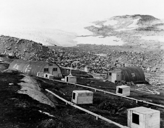
Cape Cort Adelaer served as a small weather and radio station supporting Allied operations along Greenland's eastern coast. Investigators have identified abandoned fuel storage tanks and numerous building foundations remaining from the American occupation. Engineering assessments conclude that the site likely contains mercury, petroleum contamination, asbestos, and heavy metals, resulting in an overall environmental impact classified as significant. Although historical research has begun, no comprehensive environmental investigation has yet been completed.
Skjoldungen (Louis Boplads) U.S. Operation: 1943–Approximately 1948
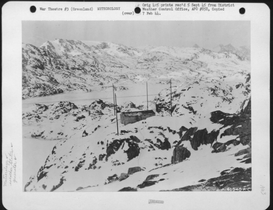
Constructed as a weather station during World War II, Skjoldungen appears to have been abandoned largely intact. Engineering investigations describe large quantities of scattered waste, including chemicals, broken glass, discarded clothing, medication residues, and other debris left where they were originally discarded. Environmental assessments conclude that mercury, petroleum contamination, heavy metals, and asbestos are likely present, resulting in a significant environmental impact. Historical investigations are underway, although no comprehensive field assessment has yet been completed.
Atterbery Dome (Comanche Bay) U.S. Operation: Approximately 1943–1945
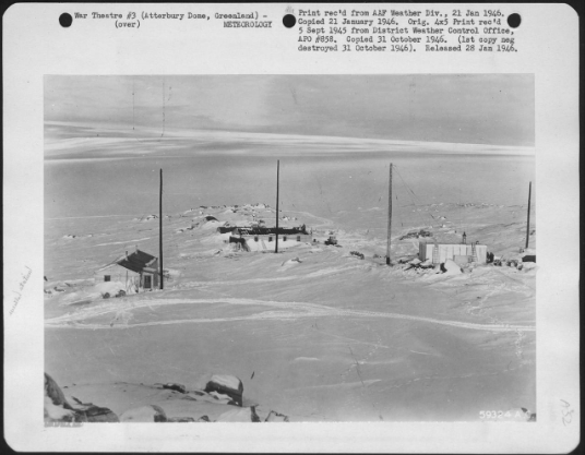
Atterbery Dome was a small radio and rescue station established during World War II along Greenland's east coast. Although modest in size, engineering investigations classify its environmental impact as significant. Remaining contamination is believed to include petroleum residues, mercury, asbestos, and heavy metals associated with deteriorating military infrastructure. Authorities have commissioned historical research to better document the installation before determining whether a full environmental investigation or cleanup should proceed.
Part III — Camp Century, the Pituffik Research Camps, Ice Cap Sites, and DYE Stations
Camp Century U.S. Operation:1959–1966(dangerous nuclear reactor operated 1960–1964)
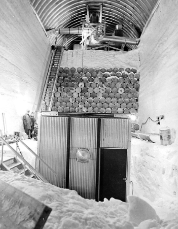
Constructed beneath the Greenland Ice Sheet approximately 150 miles east of Thule Air Base, Camp Century was the most ambitious American military installation ever built in the Arctic. Although presented publicly as a scientific research station, it also served as a testbed for Project Iceworm, a classified proposal to deploy nuclear missiles beneath the ice.
Politiken reports: "When the camp was abandoned, the nuclear reactor had been removed, but an estimated 24 million liters of radioactive cooling wastewater, 200,000 liters of diesel fuel, sewage, and roughly 9,000 metric tons of construction debris were left entombed beneath the ice. As climate warming accelerates ice loss, researchers warn these materials could eventually re-enter the environment."
Military Poisons note: NASA’s summary of the underlying scientific research describes the waste inventory somewhat differently. According to NASA, Camp Century contains approximately 200,000 liters of diesel fuel, 24 million liters of wastewater, including sewage, an unknown quantity of low-level radioactive waste, and polychlorinated biphenyls (PCBs). NASA's description does not characterize the entire 24 million liters of wastewater as "radioactive cooling wastewater."
Camp Nuto (Nunatarssuaq Take Off / Camp Red Rock) U.S. Operation:Approximately 1953–1960s No Photo
Camp Nuto was one of several research facilities established near Thule Air Base to study the engineering properties of the Greenland Ice Sheet. Researchers conducted experiments on ice ramps and vehicle operations under Arctic conditions that supported later military construction projects. Environmental investigations indicate petroleum contamination remains at the site, although the overall environmental impact has been classified as moderate. Because Camp Nuto lies within the active Pituffik military complex, it has not been included in Denmark's national cleanup program and has received only limited environmental evaluation.
Camp Tuto (Thule Take Off) U.S. Operation:1954–Early 1960s
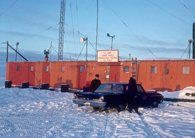
Located roughly 25 kilometers southeast of Thule Air Base, Camp Tuto became one of the Army's principal Arctic engineering laboratories. Approximately 450 personnel were stationed there to study tunnel construction beneath glaciers and excavation through frozen permafrost. Engineers built a 400-meter tunnel within the ice to evaluate the feasibility of large underground military facilities. Little public information exists concerning waste left behind, and no comprehensive environmental investigation has been reported. Because the camp remains within the broader Pituffik military area, it has not been scheduled for cleanup.
Camp Fistclench U.S. Operation:Mid-1950s–1959 No Photo
Camp Fistclench served as the direct predecessor to Camp Century. Constructed beneath the ice using covered trenches, the installation allowed Army engineers to test construction techniques later employed for the much larger Camp Century project. Scientific work focused on snow mechanics, ice behavior, and the effects of explosives on glacial ice. Following completion of Camp Century, Camp Fistclench was abandoned. Little documentation exists concerning remaining debris or contamination, and no comprehensive environmental assessment has been reported.
Ice Cap Site I U.S. Operation:1953–1954 to late 1950s No Photo
Ice Cap Site I formed part of an experimental network of radar stations constructed on the Greenland Ice Sheet to provide early warning of potential Soviet air attacks against Thule Air Base. Harsh environmental conditions and the logistical difficulty of maintaining the station limited its operational life. Publicly available information does not identify what equipment or waste remains beneath the ice, and no formal environmental assessment has been conducted.
Ice Cap Site II U.S. Operation:1953–1954 to late 1950s No Photo
Constructed alongside Ice Cap Site I, this radar installation supported the defense of Thule Air Base during the early years of the Cold War. The station was abandoned after only a few years because maintaining remote facilities on the moving ice sheet proved impractical. Little information is available regarding remaining infrastructure or environmental contamination, and no comprehensive environmental investigation has been completed.
DYE-1 (Red River) U.S. Operation:1950s–1988
.
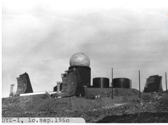
DYE-1 was one of four massive radar stations comprising Greenland's portion of the Distant Early Warning (DEW) Line, established to detect Soviet bombers approaching North America across the Arctic. The mountaintop installation featured a large radar dome and extensive support facilities. Following closure in 1988, the Greenland Self-Government reportedly undertook cleanup activities, burying waste dumps and storage areas. Unlike many former U.S. installations, DYE-1 is generally considered to have undergone substantial remediation, although little environmental data has been published.
DYE-2 (Sea Bass) U.S. Operation: Late 1950s–1980s
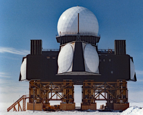
Built directly on the Greenland Ice Sheet, DYE-2 monitored Arctic airspace around the clock as part of the DEW Line. Fuel tanks and heavy infrastructure were embedded within the ice. The station was abandoned rapidly at the end of its operational life, leaving large quantities of equipment behind with the expectation that the ice sheet would permanently entomb the facility.
DYE-3 (Sob Story) U.S. Operation: Late 1950s–1980s
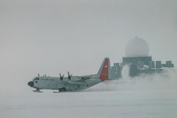
Like DYE-2, DYE-3 operated as an elevated radar station supported by ski-equipped aircraft that delivered personnel and supplies onto the Greenland Ice Sheet. In 1972, a U.S. Air Force C-130 transport crash-landed near the station. After useful equipment was removed, much of the aircraft was buried within the ice. The station itself was abandoned with substantial infrastructure remaining.
Politiken reports that the United States contributed funds for cleanup at DYE-2 and DYE-3, but publicly available records I reviewed do not substantiate that claim.
The documented cleanup agreement appears to have been financed by Denmark and Greenland, not the United States.
DYE-4 (Big Gun) U.S. Operation:1950s–1991
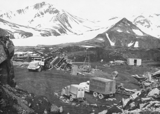
Perched atop a mountain near Kulusuk, DYE-4 was the easternmost radar station in Greenland's DEW Line. The installation contained massive rotating radar antennas housed within a large radome that monitored northern airspace throughout the Cold War. After closure in 1991, the station was dismantled by Greenland authorities in 1994, and much of the material was buried in local landfills. Only foundations remain visible today. No formal environmental assessment has been reported following the demolition.
This section highlights a striking contrast. Many of the World War II installations were abandoned with visible debris—oil drums, vehicles, buildings, and dumps. The Cold War facilities often left a different legacy: buried infrastructure, petroleum products, and, in the case of Camp Century, radioactive wastewater and diesel fuel sealed beneath the ice. As the Greenland Ice Sheet continues to thin, these hidden legacies may become increasingly important to environmental monitoring and international policy.
Part IV — LORAN Stations, Radio Stations, Artillery Sites, and Other Installations
Gamatron U.S. Operation:1942–1958
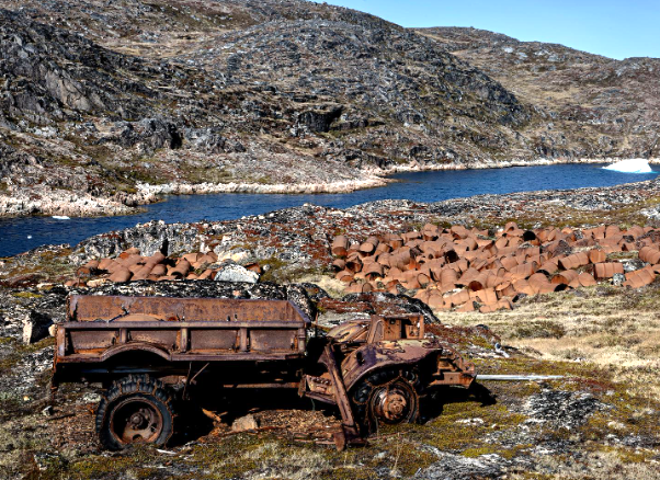
Established near present-day Qaqortoq, Gamatron served as a weather station, radio station, and submarine observation post supporting Allied operations in the North Atlantic. After the Americans departed, they left 34 buildings, six storage areas containing hundreds of oil drums, multiple waste dumps, and an estimated 175–185 metric tons of abandoned military waste. Environmental investigations found contamination severe enough that water from a nearby lake was declared unsuitable for drinking because of pollution originating from an abandoned dump.
Qutdleq U.S. Operation: 1960–1978
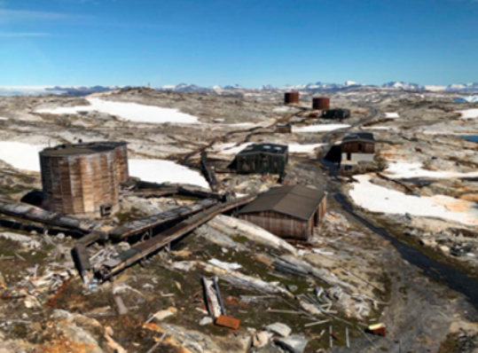
Qutdleq was constructed as a LORAN (Long Range Navigation) station on a small island in southeastern Greenland. Following its closure, numerous deteriorating buildings, communications masts, and large fuel storage tanks remained on the site. While the abandoned infrastructure is well documented, no comprehensive environmental investigation has yet been completed, leaving uncertainty regarding possible petroleum contamination or hazardous materials associated with the former installation.
Orssuiagssuaq U.S. Operation:1960–1977
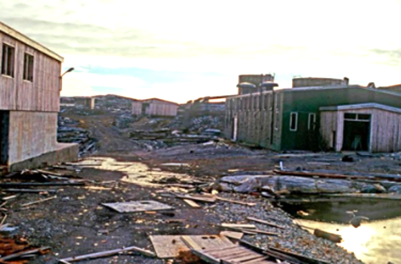
Built as another LORAN navigation station, Orssuiagssuaq was abandoned with communications towers, storage tanks, ruined buildings, and deteriorating barracks still standing decades after closure. Although the physical remains have been documented photographically, authorities have not yet completed an environmental assessment. Historical investigations are expected before decisions are made regarding cleanup or remediation of the site.
Sabine Island U.S. Operation:1959–Early 1960s
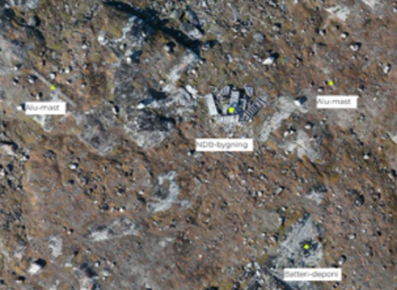
Sabine Island housed a small unmanned radio beacon located within a protected bird sanctuary. Although the station itself was modest, approximately thirty-five discarded industrial batteries remain near the antenna building, many with exposed lead cores. Authorities have concluded that the battery dump presents a potential source of heavy metal contamination. Because the installation lies within a protected wildlife area, no formal environmental assessment or cleanup has been scheduled.
Nipisat U.S. Operation: 1954–1975
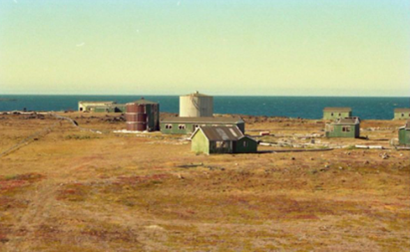
Nipisat served as a LORAN navigation station on Greenland's west coast. Environmental investigations documented multiple oil and gasoline storage tanks together with at least three confirmed petroleum spills. Engineers concluded that the site also contains PCBs, pesticides, mercury, heavy metals, and asbestos. One municipal official described the abandoned station as "something of a disaster," noting that extensive vandalism had left the once-important military installation in a severely deteriorated condition despite its location in an area of exceptional natural value.
Angissoq U.S. Operation: 1963–1994 No Photo
One of Greenland's last LORAN navigation stations, Angissoq remained in operation until satellite navigation rendered the system obsolete. The abandoned installation includes remnants of twenty-three buildings, a power plant, fuel storage facilities, and coastal waste dumps. Environmental investigators documented petroleum contamination near former fuel tanks and observed that coastal erosion is gradually exposing buried waste to the sea. A comprehensive environmental investigation has not yet been completed.
Cape Atholl U.S. Operation: 1954–1972
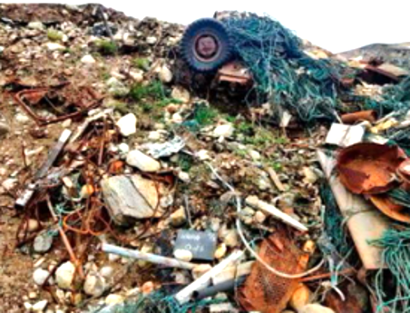
Located near Thule Air Base, Cape Atholl operated as a U.S. Coast Guard LORAN navigation station. Environmental investigations documented severe petroleum contamination, including free-phase oil, PCB-contaminated building materials, batteries, cable scrap, burned refuse, and mixed waste buried in coastal bluffs. Investigators observed erosion exposing buried debris directly onto the shoreline, creating potential pathways into the marine environment. The site also presents possible risks to wildlife, including walruses using nearby beaches. Danish and Greenlandic authorities are planning cleanup operations.
Artillery Point U.S. Operation: 1941–1946
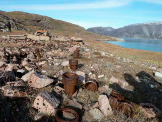
Artillery Point defended the strategically important Narsarsuaq airfield with two 155-mm coastal guns during World War II. Following the war, approximately seventeen metric tons of military waste remained, including abandoned buildings, construction materials, and a small landfill. Environmental investigations identified petroleum contamination together with low concentrations of lead and cadmium. Because the contamination is relatively limited and the site possesses historical significance, the National Museum of Greenland has recommended that the area remain largely undisturbed.
Camp Corbett U.S. Operation: 1942–1958
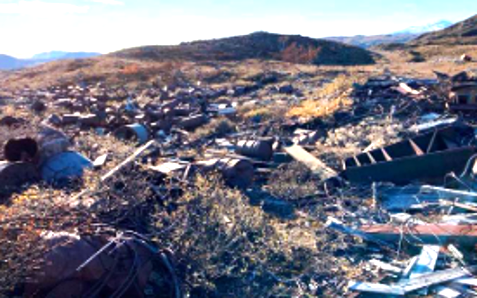
Camp Corbett functioned as a communications station supporting the nearby Narsarsuaq air base. The installation contained emergency generators, fuel tanks, hundreds of utility poles, multiple dumps, and buried waste disposal areas. Investigators estimate that at least 377 metric tons of military waste remain, including approximately 314 metric tons classified as hazardous or contaminated. Contaminants include PCBs, asbestos, heavy metals, and tar residues. Cleanup has begun, but officials report that massive reinforced concrete foundations will require extensive excavation and blasting before remediation can be completed.
Conclusion
While the Trump administration is “negotiating” with Denmark for access to three additional military installations in Greenland, and President Trump is making threatening remarks about U.S. intentions, the talks between Washington, Copenhagen, and Nuuk remain fixated on sovereignty and strategic positioning. Consequently, a critical geopolitical blind spot persists: the massive environmental liabilities scattered across dozens of legacy American military installations. These sites contain a hazardous catalog of contaminated soils, abandoned landfills, deteriorating fuel infrastructure, PCBs, petroleum, unexploded ordnance, and PFAS. Most critically, Camp Century holds radioactive and toxic waste entombed beneath the rapidly melting Greenland Ice Sheet.
Although President Trump’s critique of Danish spending in Greenland was likely unmoored from these specific ecological realities, it inadvertently highlighted a profound structural failure. The paltry sums Copenhagen has allocated to investigate and remediate this contamination pale in comparison to the actual scale of the crisis. Remediation at Camp Century alone could soar into billions of euros.
How, then, in the face of this catastrophic reality, can the Danish government continue to hide behind passive diplomatic platitudes?
While the Danish Foreign Minister publicly insists that Denmark will protect Greenland’s independence from political takeover, why are they not screaming from the rooftops about eighty years of toxic American negligence?
The environmental criminality cannot be overstated while Copenhagen treats this assault as a footnote. As Danish officials sit at the negotiating table to grant the U.S. military even more access to Greenlandic soil, why are they not aggressively demanding full, immediate remediation as a non-negotiable prerequisite? How can Copenhagen claim to stand for Greenlandic sovereignty while letting the United States get away with a multi-billion-dollar ecological crime?
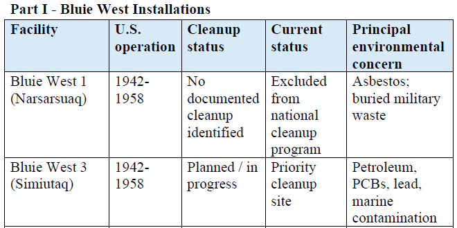
Please see the Greenland Appendix containing a spreadsheet that displays the kinds of information shown here on all 36 abandoned sites in Greenland.